


Six implementations of PinHub were successfully delivered in Riyadh municipality in the following
departments:
• General authority of studies and designs – Department of floods management
• General authority of implementation and supervision – department of floods management
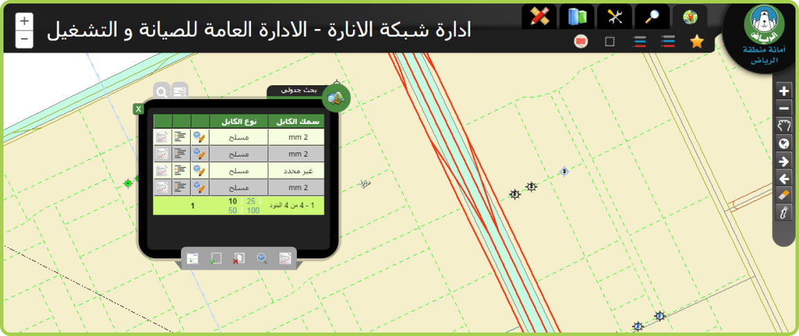
• General authority of implementation and supervision – department of electricity
• General authority of maintenance and operations – department of floods management
• General authority of maintenance and operations – department of electricity
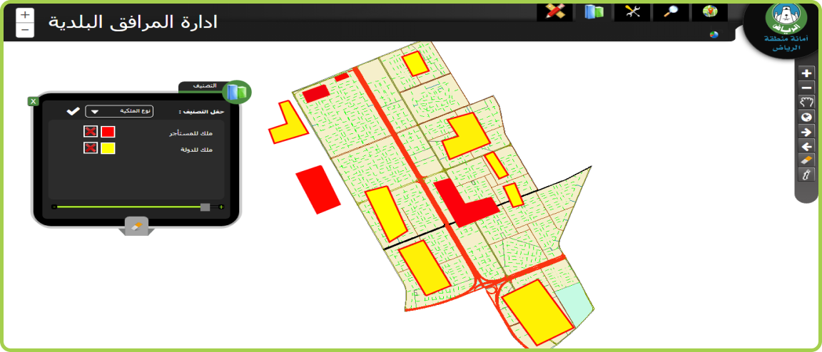
• General authority of maintenance and operations – department of municipal affairs
The six implementations are based on PinHub and were completely configured without any development or
coding activities, the six applications share common story that was completely achieved through PinHub, the
applications entitled three main permissions in three different:
• Engineering offices interface:
Engineering offices application is web based interface published over the internet and targets engineering offices where they can access PinHub using credentials registered in the municipality IT department, once the engineering office representative is authorized, the representative will be able to explore the maps of Riyadh that reside in the centralized GIS center, each engineering office will be able to preview only its own submitted solutions and will have the ability to import solution drawings from CAD files into provisional geo-database, the system will automatically validate the CAD files template, spatial reference, attributes, domains and sub-types values and spatial overlay within the solution parcel boundaries. The imported data is validated and imported into provisional geo-database.
• Reviewers interface:
Reviewers officers’ application is web based interface that targets reviewer officers where they can access
PinHub using
credentials registered in the municipality IT department, once the reviewer officer is authorized, the
reviewer officer will
be able to explore the base maps of Riyadh city that resides in the centralized GIS overlaid with the
engineering offices
submitted solutions CAD drawings’ maps (residing in provisional geo-database), the reviewer officer can
explore the
solutions drawings and will be able to perform the different queries and searches, measurements & reports,
the reviewer
officer will be able to perform web editing to the submitted solutions features and will be able to sketch
notes and share
it back with the engineering offices to re-submit the solutions drawings. The reviewer can extract the
approved
solutions at the end to pass it forward to the finalize officers.
• Finalize officer interface:
Finalize officer application is web based interface that targets finalization officers where they can access PinHub using credentials registered in the municipality IT department, once the finalize officer is authorized, he will be able to explore the base maps of Riyadh city stored in the centralized GIS center overlaid with the live geo-database maps of the engineering offices solutions maps, the finalization officer accesses the final geo-database for the engineering officers and have capabilities and tools to perform map explorations, map printing, searching and querying, reporting & printing, measurement tools, simple runtime classification tools, live editing tools on the solutions geo-database and data import features. The finalize officer imports the extracted CAD files that were generated by the reviewer officer, the system automatically validates the imported files using many spatial and tabular validations, once the files are validated, the data will be directly imported into the centralized geo-database. The above solution performs business case scenario using PinHub without the need to develop any code, the centralized GIS center is now getting updates from the contractors and engineering officers frequently which reflects the up to date level of the centralized GIS data.
Solution implementation for the six departments was completely live in three months, the solution adds a
lot of values to Riyadh municipality such as:
• De-centralized management to the centralized geo-database which reflects less workload on the department
officers.
• More robust and easy communication process with engineering offices process.
• Automation to the procedures of engineering offices solutions submission.
• Better quality in solutions drawings using the import tool automatic validations.
• Up to date geo-database without the need to perform field surveys
• Live monitoring from department to contractors solutions progress using GIS
• More satisfaction from both the engineering offices and citizens
• More efficiency in information enquiring and reporting
• Secure system, each department explores its own data
• Easy integration between different departments in one single interface


